Topography

This is a map of Auckland City. It focuses on Albert Park and the surrounding area. There are two layers to this map. The first is a property titles outline, showing the surrounding buildings and the land they use/take up. Below this, the red lines represent the topography of the land. A topographic map uses contour lines to show elevation, the closer the lines are together the steeper the land.
The red maker represents Albert Park. The left had side of the park looking at it from this perspective has two contour lines rather close this tells us that this area of the park is steep in gradient.
History
The original Maori settlers knew the area as Rangipuke,
The hill on which Albert Park is situated on is volcanic nature. The whole area of Auckland is full of volcanos this particular area was created over 60,00 years ago. It was formed by ash.
- There was a colonial army base located on site between the years of 1840-1850
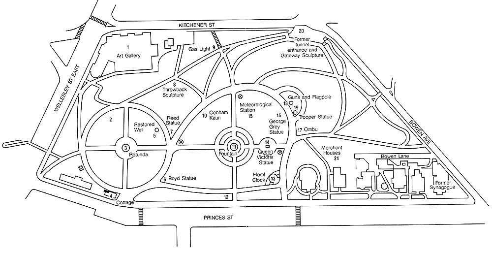
- The Auckland City Council took over the area in 1879 and by 1880 it had become a designated public park.
Tunnels
Albert park has a series of tunnels the run beneath it. These tunnels were built during WW2 as a preventative measure. New Zealand was under threat of a potential invasion and it became aware that something had to be done in order to keep the public safe. The tunnels are actually a purpose built air raid shelter, (they were built with the intention of fitting the entirety of Auckland CBDs population at the time) The main tunnel is 660m long.


